File:Shelter Hall, Brighton (GooglePhoto ~2015).jpg
From The Brighton Toy and Model Index
Jump to navigationJump to search
Size of this preview: 800 × 486 pixels. Other resolution: 1,280 × 778 pixels.
Original file (1,280 × 778 pixels, file size: 362 KB, MIME type: image/jpeg)
Summary
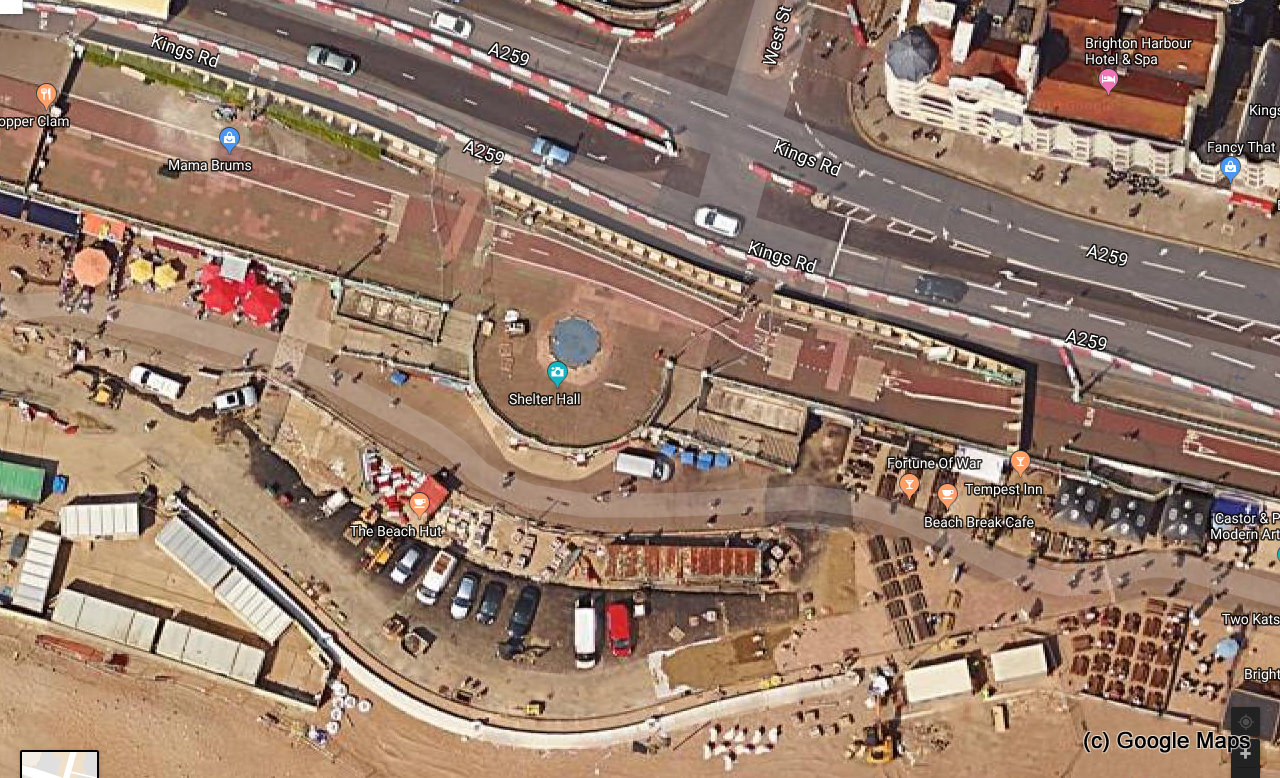
Aerial/satellite view of Shelter Hall, Brighton, courtesy of Google Maps.
The image shows the road-rerouting that took place after the 2014 structural failure under the roadway, but doesn't yet show the subsequent cordoning off and demolition of the rotunda, in around 2017-ish.
File history
Click on a date/time to view the file as it appeared at that time.
| Date/Time | Thumbnail | Dimensions | User | Comment | |
|---|---|---|---|---|---|
| current | 13:27, 27 July 2018 | | 1,280 × 778 (362 KB) | BTMM Eric (talk | contribs) | Aerial/satellite view of '''Shelter Hall, Brighton''', courtesy of Google Maps. The image shows the road-rerouting that took place after the 2014 structural failure under the roadway, but doesn't yet show the subsequent cordoning off and demo... |
You cannot overwrite this file.
File usage
The following page uses this file:

.jpg&oldid=47561)
.jpg)
.jpg&action=edit&redlink=1)
.jpg&action=edit)
.jpg&action=history)
.jpg)
.jpg)
.jpg&oldid=47561)
.jpg&action=info)